
New Smyrna Beach Block Sources
Official sources answer different parts of a neighbor question. Start with geometry, move to ownership, and stop short of claiming current occupancy. New Smyrna Beach neighbors may include owners, renters, seasonal occupants, and protected residents whom a parcel roll cannot enumerate.
| Source | What It Shows About a Block | Access |
|---|---|---|
| City GIS | Touching parcels, PID, AltKey, class, district | Free map |
| VCPA roll | Owner, situs, mailing address, use, exemption | Free search |
| Clerk deeds | Transfers, liens, plats, legal descriptions | Web and DeLand |
| Voter file | Nonexempt registrations under use limits | Lawful request |
| Community groups | Voluntary public leaders and business contacts | Group-specific |
A deed proves a recorded interest. A mailing-versus-situs match and homestead flag can support owner-occupancy, but neither lists the household. Label each finding precisely.
New Smyrna Beach GIS Hand-Off
The city interactive map searches address, parcel ID, or AltKey and shows parcels, zoning, land use, flood zones, districts, and roads. Its popup omits owner names. It gives PID, AltKey, tax district, class, address, and official links to VCPA and plat search.
The split keeps a map label from becoming a household claim. Follow VCPA for ownership. Measure gives distance context, but no radius, buffer, or multi-parcel selection tool was verified.
Map New Smyrna Beach Neighbors
Build the block from visible parcel edges, not an invented radius. The inspected 130 Sams Avenue popup showed parcel identifiers, district, class, and address, but no owner, renter, phone, birth date, utility customer, or household data.
- Locate the known address and zoom until parcel outlines are clear.
- Record its PID and AltKey, then click each touching polygon.
- Follow each VCPA link and record owner, situs, mailing address, and exemption.
- Use Measure for context and state which parcels were included.
This makes an adjoining-owner list, not a resident roster. For a whole road, use the New Smyrna Beach street directory.
New Smyrna Beach's 24 Neighborhoods
Official planning documents divide the city into 24 neighborhoods, up from 12 as annexations and boundaries grew. Named areas include North Beach, Central Beach, Coronado Beach, Coronado Island, South Causeway, Inlet Shores, North Mainland, and Airport Industrial. They supply block context, not household directories.
North Beach includes Minorca and Smyrna Dunes. Central Beach mixes homes with Flagler Avenue commerce. South Causeway includes single-family areas and Bouchelle Island. North Mainland includes Turnbull Bay, Doris Leeper Preserve, and Atlantic Center for the Arts. Such patterns explain why condos and older blocks require different searches.
Public New Smyrna Beach Contacts
Community groups publish selected leaders or business contacts, not a verified list of neighbors. No authoritative current residential HOA inventory or public member directory was found.
Neighborhood Council
The city Form Center provides chair and vice-chair contact routes.
Flagler Avenue
The business association offers a beachside commercial contact layer.
Canal Street
The historic district network identifies public merchants.
Volusia Chamber
Its directory filters organizations by category and postal code.
Florida Voter Data Near Blocks
The individual Volusia voter route is not an anonymous street browser. A lawful request may provide nonexempt fields, but §98.095 restricts use to elections, political or governmental activity, voter registration, or law enforcement. Registration supports a dated administrative fact, not physical presence.
The Florida voter confidentiality statute shown below governs protected identifiers and records.
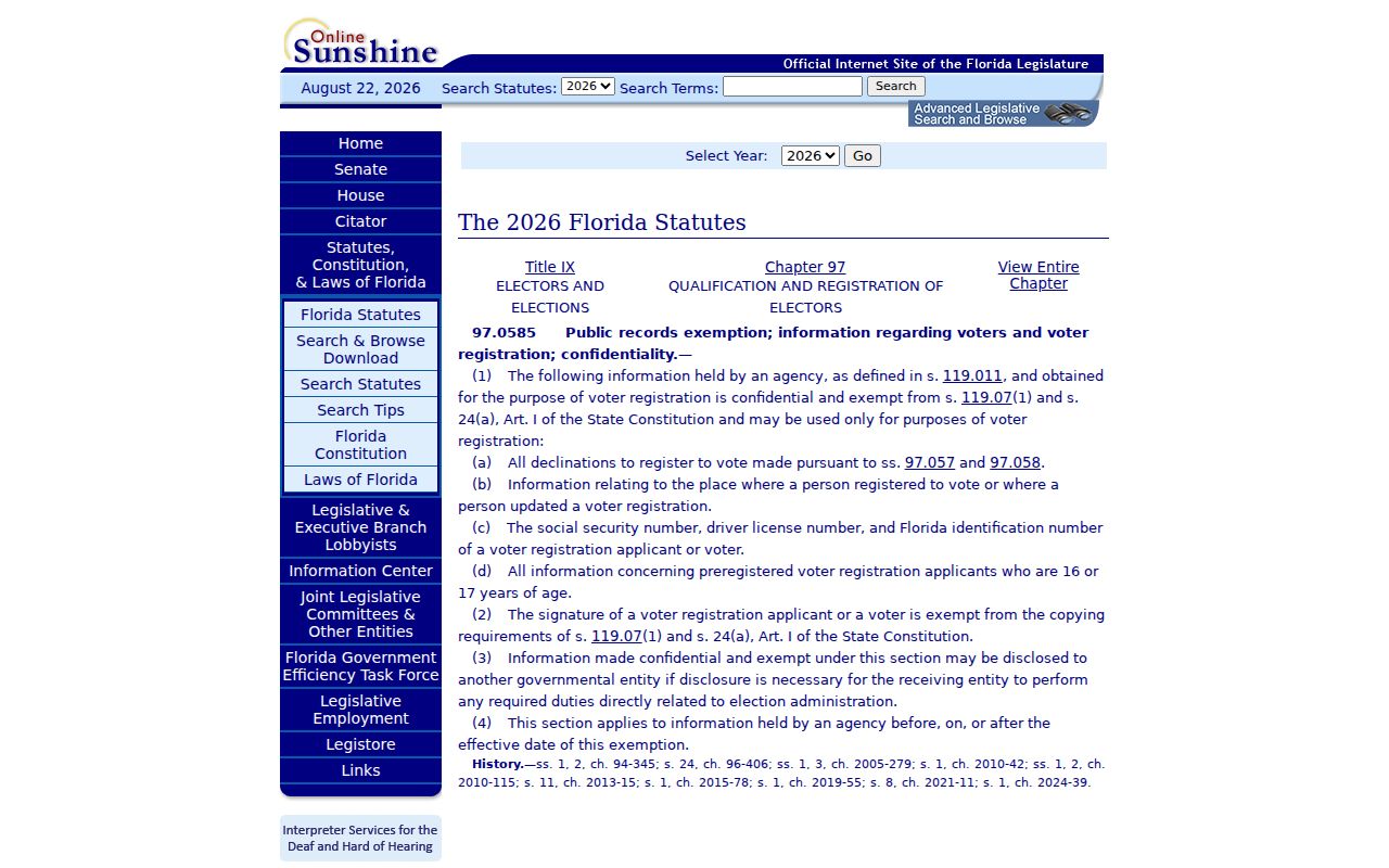
The official text helps separate public registration fields from confidential identifiers, signatures, minors, and protected voters.
Official Rolls Versus Neighbor Tools
Commercial tools may merge stale or poorly matched data. Official rolls are narrower, but have a custodian, record date, and defined meaning.
| Question | Official route | Commercial category |
|---|---|---|
| Parcel owner | VCPA, then deed | May lag |
| Touching parcels | City GIS | Method may be hidden |
| Current household | No complete public roll | May overstate guesses |
Use official sources for the facts they keep, and leave unknown details unknown.
Protect New Smyrna Beach Neighbors
Renters and household members are not indexed by the property roll. Utility and delivery data do not form public block directories. Safe at Home gives qualifying victims a substitute address, and §119.071 can shield address and family details for protected groups.
Lawful use. Look up New Smyrna Beach neighbors for civic curiosity, reconnection, or personal safety awareness. Florida law prohibits stalking, harassment, threats, and criminal misuse.
Owner, registrant, organization contact, and historical occupant are distinct roles. Keeping those labels intact protects your neighbors and improves accuracy.
Test New Smyrna Beach Ownership
VCPA Classic accepts parcel ID, Alternate Key, owner, street parts, city, ZIP, subdivision, block, lot, property class, and millage group. For adjoining land, use the keys collected from GIS instead of names. Results identify the parcel, owner, site address, city, and class.
Advanced search separates situs filters from owner mailing filters and adds neighborhood, tax district, ZIP, value, building count, homestead, land, building, and sales criteria. A matching mailing and situs address is useful but not conclusive. Weekly updates mean a recent transfer may not yet appear. Confirm key ownership through the clerk deed.
- Parcel
- A mapped unit of land with its own ID.
- Situs
- The physical property address.
- Mailing address
- Where tax notices are sent.
- Homestead
- An exemption that may support owner-occupancy without naming a household.
The appraiser's New Smyrna Beach office is at 124 N. Riverside Drive, Suite 101, and the residential division phone is 386-423-3315. A custom data extract can be requested from VCPA when the public interface cannot provide the needed parcel fields. State the exact area and columns, ask about cost first, and allow the office's stated processing period after prepayment. This is more transparent than relying on a commercial list whose date and matching method may be unknown.
Read New Smyrna Beach Block Context
A New Smyrna Beach mailing address does not by itself prove that a parcel sits inside city limits. Compare the city boundary, tax district, and county GIS before assigning a neighborhood or city service. A 2022 interlocal change placed development services for mapped unincorporated areas with Volusia County. ZIP, city boundary, planning neighborhood, and tax district answer separate questions.
The GIS layers for zoning, future land use, annexation, historic districts, overlays, and the airport plan can explain why adjacent parcels look or function differently. They do not identify the people inside. Record the layer name and inspection date because adopted boundaries can change. For permits or code cases, verify whether the city or county is the proper custodian before searching by address.
Development patterns matter too. North Beach spans many building eras and includes the large Minorca project. Central Beach combines residential blocks with the Flagler Avenue business area. Coronado Beach is chiefly single-family between South Atlantic and Saxon, with more mixed development east of Atlantic. These facts guide the parcel method without turning planning labels into assumptions about residents.
Community Lists Are Not Neighbors
The city's Neighborhood Council contact route helps reach public chairs and vice-chairs. Flagler Avenue, Canal Street, and the Southeast Volusia Chamber add public business or organization contacts. They are valuable when the goal is a civic question, a public event, or a local service. They do not establish who occupies nearby homes.
No verified municipal cemetery database, current HOA-member directory, neighborhood-watch roster, congregation list, utility-customer roll, or complete residential association inventory was found. A private group may choose to limit a member roster even when its leaders are public. Ask the organization for its public contact channel instead of treating membership as an open record.
When meeting nearby people is the real aim, public events and published association contacts are the sound route. Do not infer children, renters, daily schedules, family ties, or protected residents from parcel or voter data. If a safety issue is urgent, use emergency or non-emergency public services rather than assembling a private watch list.
Verify New Smyrna Beach Neighbor Findings
Save the GIS parcel ID first. Then note the VCPA record date, owner role, mailing address, situs address, and homestead status. If title matters, open the clerk deed and match its legal description. For every surrounding parcel, apply the same steps. A consistent method avoids giving extra weight to the first result that looks familiar.
Newly recorded instruments may not appear until the clerk records, indexes, verifies, and releases them. Property data are described as updating weekly. A recent sale can therefore create a short conflict between systems. State both dates and check again instead of choosing the source that best fits an assumption.
For historical block questions, use directories, census schedules, maps, and newspapers through Sheldon Research Library or Volusia County Public Library. Keep that older household work separate from a present-day neighbor lookup. One address can hold several families over time, and a current parcel can replace multiple older lots or structures.
Revisit the parcel map when the question remains open. New construction, lot combinations, recorded transfers, and weekly roll updates can change a New Smyrna Beach neighbor result after the first search date. Save the old result before checking again, since the change itself may explain the mismatch.